|
|
Letchworth-Love Mound
and Solar Timekeeping |
Timekeeping
=>
The Mound
=>
The Top
=>
Conclusions
|
As noted previously, in the present time the top of the central mound is a rounded, eroded
dome. In its current state it would be unusable for reliably observing the position of the
sun on the horizon at sunrise and sunset. Therefore, I've attempted a virtual
restoration of the original platform, based on the slope and shape of the body of the mound.
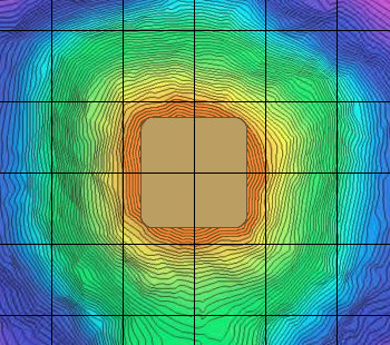
This rounding and erosion are easily visible in the this image. The innermost (highest) contour lines are the most distorted, becoming more regular at each lower elevation. I arbitrarily selected the eighth level down as having the necessary regular shape to build on. The small, oddly-shaped contour line left of center is from the pile of dirt removed from the excavation pit, just to the right of it, and I've ignored both. |
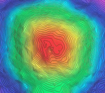
A lidar/topological map of the central mound, with color-coded elevation.
|
| I erased all contour lines within the one selected, effectively removing the top seven feet or so of the top and leaving a flat surface. |
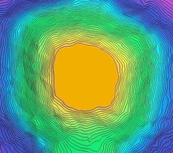
The central mound with the top seven feet removed.
|
| I then isolated the eighth contour line, and made seven copies of it, each progressively smaller, and replaced the removed contour lines with them. They are sized so as to continue the general slope of the body of the mount up to the new top. I've shadowed in the original contour lines for reference. Note that even with the vertical aspect of the erosion process removed, the shape of the new intermediate top still reflects the erosion on the sides of the mound. |
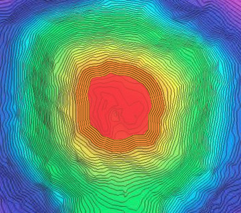
The mound with the new intermediate top.
|
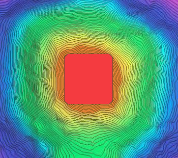
| It's next necessary to recover the rectangular shape of the top platform. Since erosion only made the top smaller, never larger, I decided the best guess would be to enclose the intermediate top in a rectangle whose sides touch it on all four sides. |

Enclosing the intermediate top in a rectangle.
|
| Here's the reconstructed platform, sharp corners removed, and colored to represent the height. |
The fully reconstructed top platform.
|
| Finally, colored to represent bare earth and overlaid with a 10-meter grid aligned to the center of the mound. |
Colored to represent bare earth and overlaid with 10-meter grid.
|
© 2024 Michael L. Wright