|
|
Letchworth-Love Mound
and Solar Timekeeping |
Timekeeping
=>
The Mound
=>
The Top
=>
Conclusions
|
The Letchwork-Love Mounds complex is located in Jefferson County, Florida, about seven miles west of
Monticello. The primary mound is the tallest Native American ceremonial mound in Florida, and
is believed to have been built 1100-1800 years ago. Its top platform is around 50 feet above the
surrounding terrain, with a secondary platform of similar area at about half that height. Despite
centuries of wear, it's still an impressive sight. Currently the area is under protection as
a
Florida State Park.
The mound possesses several notable features.
There is a very old excavation pit on top of the central mound, clearly visible in ground imaging. It's a scar but it also provides a useful reference point for measurements since its position is relatively easy to locate, even from ground level. Why this mound was built and how it was utilized is lost in the proverbial mists of time. Since many such constructions have been used in various cultures for the purpose of observing the yearly progression of the position of the Sun at sunrise and sunset in order to mark the seasons, it's reasonable to conjecture that the main mound at Letchworth may have been used as just such a solar calendar. In that spirit, I'm going to examine what the mound probably looked like when it was built, and from there try to determine if its inherent geometry would have lent itself to that function. |
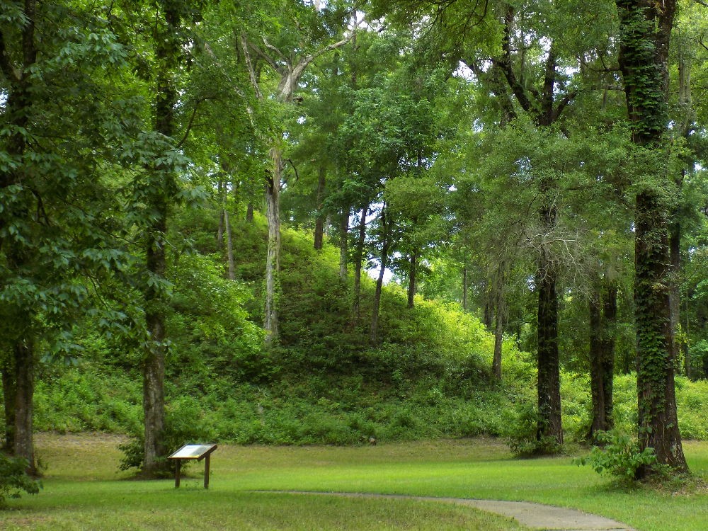
The smooth slope of the mound is easy to see in this photo, which also gives some sense of the
size. This is the northwest corner, viewed from the north.
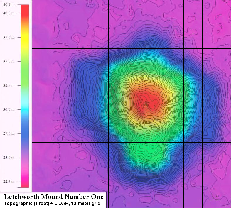
A composite image comprising color-coded Lidar elevation, topographic contour lines, and a 10-meter
grid centered on the infamous excavation pit on the top.
Graphic taken from INVESTIGATING MONUMENTAL ARCHITECTURE AT THE LETCHWORTH MOUNDS SITE (8JE337) (2013) by Daniel M. Seinfeld and Daniel P. Bigman, page 28. 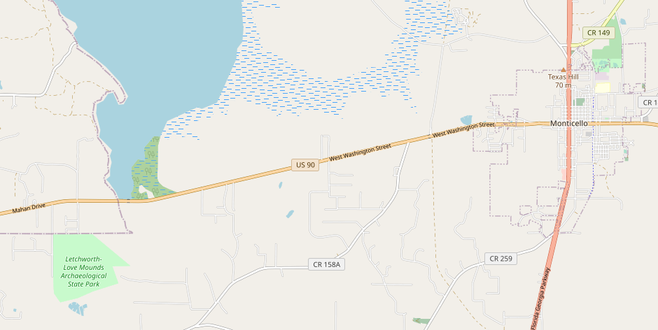
The site is located about seven miles west of Monticello. Florida, near Lake Miccosukee.
|
© 2024 Michael L. Wright